Smart City Flood Intelligence Texas Flood Emergency Warning Systems
Connecting rural upstream watersheds to urban downstream communities through Corvalent's CorGrid platform — earlier awareness, coordinated response, and a resilient single pane of glass for Texas emergency management.
Understanding the Texas Flood Emergency Warning Opportunity
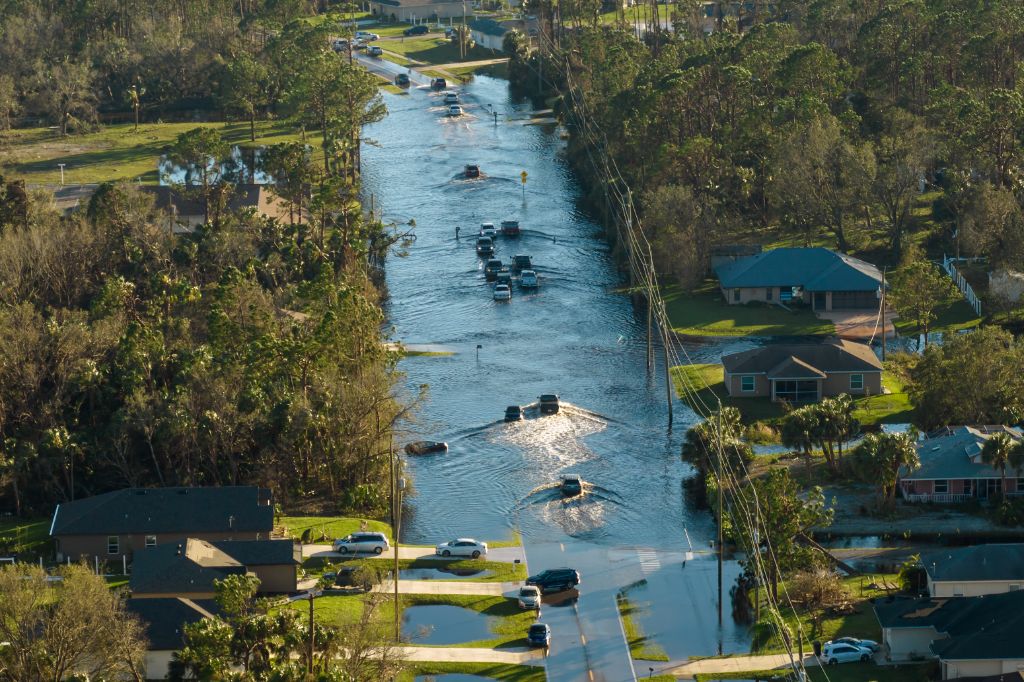
Flood risk is a regional and interconnected challenge. An effective Flood Emergency Warning System connects upstream rainfall, creek, river, reservoir, drainage, and low-water-crossing data with downstream urban monitoring and emergency operations.
A Regional, Interconnected Challenge
Rainfall and water-level changes may first occur in sparsely populated upstream locations before affecting downstream communities, transportation corridors, low-water crossings, drainage systems, schools, hospitals, and emergency-response routes.
DIR-CPO-6230 Contract Pathway
The active Texas DIR contract DIR-CPO-6230 establishes a procurement path for Flood Early Warning Systems products and services, identifying Corvalent and BLCCS among the offered brands, open to eligible state and local government organizations.
Aligned with Smart-City Strategy
Deloitte describes modern urban transformation as a convergence of sustainability, infrastructure, digital modernization, artificial intelligence, cybersecurity, and advanced connectivity — with real-time monitoring reducing the effects of extreme weather.
Resilience Through Data
McKinsey emphasizes that cities should understand climate risk, incorporate it into planning, and implement early-warning systems — highlighting the role of technology and data in preventive action and long-term resilience.
Why Fragmented Monitoring Falls Short
Delayed Visibility
Isolated rural sensors rarely inform downstream urban operations in time, reducing effective warning lead time.
Fragmented Operational Picture
Multiple sensor brands, departments, and jurisdictions without a single pane of glass make coordinated response difficult.
Manual, Reactive Escalation
Without automated thresholds and escalation workflows, response depends on manual monitoring and reactive judgment calls.
Unmonitored Field Assets
Dead batteries, weak signal, and telemetry gaps often go unnoticed until a device is needed most.
About Corvalent & The CorGrid Platform
32 years of experience delivering advanced IoT, AIoT, and Edge Computing solutions — with CorGrid as the central intelligence layer for flood emergency warning.
About Corvalent
American Technology Company — 32 Years
Corvalent specializes in developing and integrating advanced IoT, AIoT — Artificial Intelligence of Things — and Edge Computing solutions, combining industrial-grade hardware, edge intelligence, communications, software, analytics, and technical services into integrated Technology-as-a-Service ecosystems.
32 years of experience with an international presence
Experience across Smart Cities, Smart Buildings, Smart Energy
Experience across Smart Machines, Smart Processes, Special Projects
Connects flood intelligence with the wider community operational environment
CorGrid Platform
Modular, Scalable, Data-Driven IoT Platform
CorGrid functions as the central intelligence layer of Corvalent's Smart Solutions, connecting sensors, gateways, assets, systems, users, and operational workflows — providing a unified view of rainfall, water levels, low-water crossings, and field-device health.
Real-time monitoring of thousands of distributed sensors and assets
Configurable rules, advanced alerts, and escalation automation
Historical analysis and asset-health monitoring
Fully customizable dashboards for operational and executive KPIs
Flexible SaaS, TaaS, on-premises, and hybrid architectures
Agnostic design — integrates with existing sensors, GIS, and legacy systems
How the Smart IoT Solution Strengthens Flood Preparedness
Six connected capabilities that turn distributed watershed data into early, reliable, and coordinated emergency action.
Integrated Rural & Urban Monitoring
A Connected Watershed Perspective
Rain gauges, weather stations, creek-level sensors, reservoir instrumentation, and watershed monitoring devices deployed upstream are correlated with downstream urban channels, stormwater systems, low-water crossings, roads, bridges, and critical facilities.
Rainfall intensity and accumulated rainfall tracking
Water-level elevation and rate-of-rise analysis
Upstream-to-downstream propagation time modeling
Estimated warning lead-time calculation
A Single Pane of Glass
Unified Flood Intelligence Environment
CorGrid consolidates telemetry from multiple sensor brands, communication technologies, departments, and jurisdictions into a unified operational environment — improving shared situational awareness across teams.
Executive dashboards summarizing regional risk
Operational dashboards for emergency management, public works, transportation
Device status, field incidents, and geographic risk areas in one view
No more switching between unrelated applications
Automated Thresholds & Escalations
Configurable Response Workflows
Configurable rules continuously evaluate rainfall, water levels, rates of change, equipment status, and combinations of conditions — applying escalation levels such as advisory, watch, warning, and critical.
Alert-generation latency and acknowledgment-time tracking
Escalation routing by location, severity, time of day, jurisdiction
Notifications directed to appropriate personnel or external systems
Time-between-detection-and-action measurement
Low-Water Crossing Protection
Roadway & Critical-Infrastructure Safety
Water-level sensors, cameras, warning beacons, gate status, and local edge devices provide real-time visibility into low-water crossings, bridges, drainage structures, pump stations, and emergency-access routes.
Automatic alerts and dashboard updates on hazardous conditions
Service/incident ticket creation and warning-equipment activation
Information sharing with responsible agencies
Extendable to bridges, utilities, and public buildings
Predictive Asset Maintenance
System Readiness Before It Matters Most
CorGrid monitors sensor connectivity, battery level, signal strength, telemetry gaps, gateway availability, device health, calibration schedules, and abnormal behavior so field equipment stays operational before and during an event.
Sensor availability and communication uptime tracking
Battery condition and data-completeness monitoring
Prioritized field-visit recommendations by risk and location
Percentage of network ready for severe-weather operations
Historical Analysis
Continuous Improvement Over Time
Historical rainfall, water-level, alert, incident, and response information supports post-event analysis, infrastructure planning, grant applications, after-action reviews, and future system expansion.
Comparison of actual conditions against established thresholds
Identification of geographic or operational gaps
Support for sensor-placement decisions and emergency exercises
Aligned with NOAA-supported flood-forecasting research
Key Technologies for Resilience
Eight technology pillars combined into a robust, scalable, and secure flood-intelligence environment.
Water-Level & Flow Monitoring
Radar, ultrasonic, pressure, and other hydrological sensors continuously measure levels in creeks, rivers, channels, reservoirs, and low-water crossings.
Rainfall & Weather Monitoring
Rain gauges and compact weather stations provide localized precipitation and atmospheric data, combined with water-level readings.
Edge Computing
Industrial edge devices collect and normalize field data, preserve information during intermittent communications, and execute critical rules locally.
Multi-Network Telemetry
Cellular, radio, LoRaWAN, satellite, Ethernet, and Wi-Fi are selected according to coverage, bandwidth, power, terrain, and resilience needs.
GIS Mapping
Sensors, watersheds, roads, bridges, facilities, and risk areas are represented geographically — showing not just what, but where and what may be affected.
AI & Advanced Analytics
Analytics identify abnormal patterns, correlate rainfall with water-level response, estimate propagation, and prioritize alerts — augmenting, not replacing, human judgment.
Integrated Public Warning
Integration with approved notification, dispatch, incident-management, signage, beacon, and messaging systems creates a path from field detection to public communication.
Cybersecurity & Governance
Role-based access, secure device communication, auditability, and data-ownership governance are essential components of a public-sector IoT environment.
Expected Benefits
Nine outcomes Texas communities can expect from a connected flood-intelligence environment built on CorGrid.
Operational Efficiency
A unified platform reduces fragmented monitoring and gives teams a consistent view of developing conditions.
Earlier Flood Awareness
Upstream monitoring provides additional context and potential lead time before downstream areas are affected.
Predictive Maintenance
Continuous device-health monitoring identifies weak batteries, communication failures, and degraded sensors early.
Public Infrastructure Management
Flood information connects to roads, bridges, drainage, utilities, public buildings, schools, and emergency facilities.
Resource Optimization
Geographic risk information helps prioritize field inspections, barricades, road closures, and personnel deployment.
Sustainability & Resilience
Historical and real-time data supports informed infrastructure investments and long-term community resilience.
Safety & Compliance
Automated alerts, auditable event histories, and structured escalation support accountable decision-making.
Interagency Coordination
Shared dashboards and standardized information enable departments and jurisdictions to collaborate from one picture.
Scalable Smart-City Foundation
The same CorGrid environment can later incorporate public safety, environmental monitoring, mobility, and energy use cases.
Grounded in Independent Research
This approach is informed by public procurement documentation and independent research on smart-city resilience and flood early-warning systems.
Official Contract Vehicle
Texas DIR — DIR-CPO-6230
Official contract information for Flood Early Warning Systems technology products and related services, including Corvalent and BLCCS offerings.
Procurement Pathway
Convergence & Governance
Deloitte — Smart Cities & Urban Transformation
Research addressing the convergence of sustainability, infrastructure, digital modernization, artificial intelligence, connectivity, and urban services.
Strategic Alignment
Data-Driven Resilience
McKinsey & Company — Smarter Cities
Analysis of how data, IoT, and smart technologies strengthen preventive action, emergency response, and long-term urban resilience.
Risk Reduction
Warning-System Value
NOAA — Economic Value of Flood Forecasts
Review of the role of flood-warning information in protective decisions and flood-related outcomes, from the NOAA Institutional Repository.
Protective Decisions
Complete Source List
Texas Department of Information Resources — DIR-CPO-6230: Official contract information via The D.H. Collective LLC, including Corvalent and BLCCS offerings.
The D.H. Collective — Texas FEWS Contract: Overview of participating technology, integration, telemetry, and program-support capabilities.
Deloitte — Smart Cities & Urban Transformation: Convergence of sustainability, infrastructure, digital modernization, AI, connectivity, and urban services.
Deloitte Insights — Five Approaches for Climate-Resilient Cities: Governance, innovation, risk reduction, and municipal investment in monitoring technologies.
McKinsey & Company — Smarter Cities Are Resilient Cities: How data and IoT strengthen preventive action and infrastructure reliability.
McKinsey & Company — Ensuring Adaptation and Resilience to Climate Change: Climate-risk assessment, resilience planning, and early-warning systems.
NOAA Institutional Repository / Natural Hazards Review: Economic value of flood forecasts and early-warning systems in protective decisions.
¹ All sources referenced are publicly available research and procurement documentation as summarized by Corvalent for this presentation.
CorGrid in Operation
See how the CorGrid platform consolidates flood-intelligence data — from watershed overview to field-asset readiness.
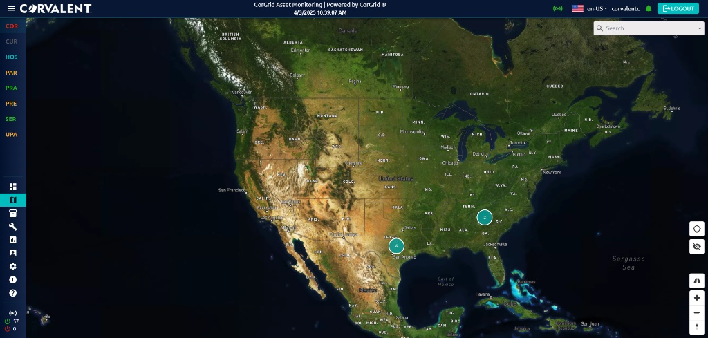
Regional Watershed Overview
Rainfall, river/creek levels, and reservoir status across upstream and downstream monitoring points in a single map-based view.
Reference Materials
Technical documentation, briefing audio, and demonstration video for further exploration of the Flood Intelligence solution.
Texas Emergency Management
Smart City Flood Intelligence Overview
Executive overview of the Texas Flood Emergency Warning opportunity: context, CorGrid solution, benefits, and next steps.
A structured path to a scalable flood-intelligence foundation, beginning with a Discovery & Technical Alignment Workshop.
01
Discovery & Technical Alignment Workshop
Bring together emergency management, public works, stormwater, transportation, IT, GIS, public safety, engineering, and procurement stakeholders.
02
Map Priority Watersheds & Assets
Identify priority watersheds, flood-prone corridors, low-water crossings, and critical facilities; review existing sensors, GIS, and telemetry.
03
Thresholds & Proof of Concept
Define operational thresholds, KPIs (warning lead time, alert latency, network readiness), and design an initial upstream/downstream POC.
04
Phased Roadmap & Procurement
Develop a phased implementation roadmap and procurement strategy under the applicable Texas DIR contract (DIR-CPO-6230).
Ready to strengthen flood preparedness?
Schedule a conversation with Denise Manchester, Director of Program Strategy and Development, to explore how Corvalent's CorGrid platform can support your community's flood emergency warning roadmap.